Drones
Taetron offers a comprehensive list of Drones. Such products are grouped into Power Source, Navigation and Control Method, Flight and Altitude Range, Environmental Suitability, Size and Weight, Payload, Motor & Wing and Rotor Type, and Specialized Functionality.
Through two decades of innovation, Taetron has become a leader in Drones serving corporations and institutions in the U.S., Canada, and globally.
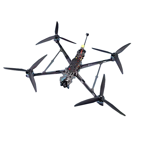
10 Inch Heavy Duty Payload FPV Drone with 1200TVL Camera – Taetron
10-Inch Racing Drone with Controller and Payload Capacity carbon fiber frame, long-endurance kit, 4KG payload, 7km flight.
Technical Specifications
| Type | racing drone with controller | |
| Battery | 4s 6s 3300 2500 4000 6000 li-po battery | |
| ESC | 60A-70A 4IN1 Brushless SC | |
| Camera | 1200TVL 165° Wide angle camera 480P | |
| Propeller | Flash 10-inch propeller | |
| Flight control | F405 |
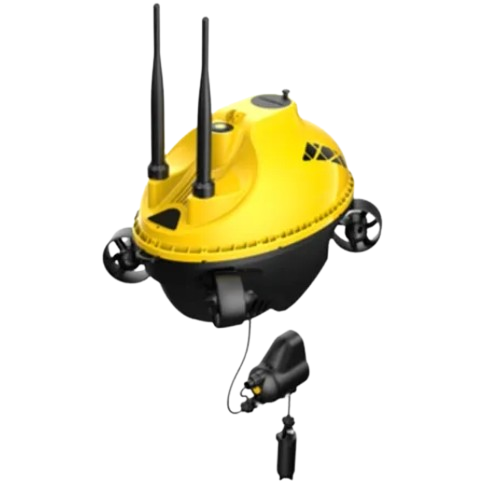
1080 P Full HD Digital Stellar Camera with GPS, Night Vision – Taetron
1080P Digital Stellar Camera with GPS, night vision, 92 ft (28 m) depth, and 6-hour battery. Real-time display, broadcasting, and sharing.
Technical Specifications
| CMOS | 1/2.8 |
| Lens Aperture | F2.0 |
| Focal Length (EFL) | 0.11 in (2.7 mm) |
| ISO Range | 100-102400 |
| FOV | Diagonal 164.6° |
| Photo Maximum Resolution | 2MP (1920*1080) |
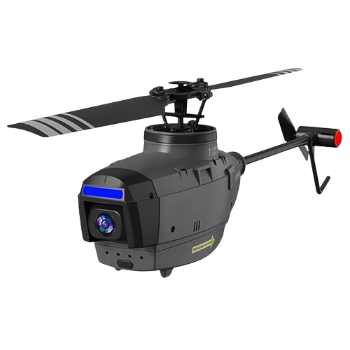
1080p FHD RC Helicopter with FPV and AI Recognition – Taetron
Experience Stunning 1080p FHD Aerial Photography with Our App-Controlled RC Helicopter, Featuring Obstacle Avoidance and a remote range of up to 656 ft.
Technical Specifications
| Remote Distance | 492.13 ft to 656.17 ft (150 m to 200 m) |
| Controller Battery | 4 x AA battery |
| Material | Plastic |
| Features | App-controlled, FPV capable, integrated camera, obstacle avoidance, Wi-Fi, AI intelligent recognition |
| Video Capture Resolution | 1080p FHD |
| Operator Skill Level | Beginner, intermediate, expert |
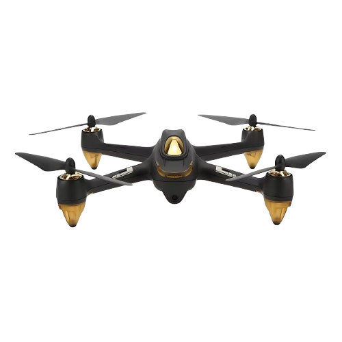
1080P HD FPV Quadcopter With GPS Brushless Motors & Return Home – Taetron
Explore the Quadcopter, featuring 1080P HD camera, Low Voltage Alarm & Battery Protection, GPS, FPV, and headless mode. Long 20-minute flight time.
Technical Specifications
| Frequency | 2.4G/5.8G |
| Channel | 12CH |
| Gyro | 6-axis |
| Flight Time | 20 to 25 mins |
| Charging Time | About 50 mins |
| Control Distance | > 0.18 mi (> 300 m) |
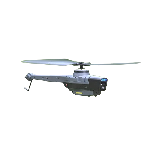
2-Channel Gray RC Helicopter with Camera and Dual Motors – Taetron
Experience smooth flights with this RC Helicopter, featuring 1080p video, dual motors, and easy controls. Ideal for indoor and outdoor fun.
Technical Specifications
| Material | Plastic |
| Video Capture Resolution | 1080p FHD |
| Operator Skill Level | Beginner |
| Indoor/Outdoor Use | Indoor-outdoor |
| State of Assembly | Ready-to-go |
| Control Channels | 2 channels |

265mm FPV Drone with T700 Carbon Frame and 13-Inch Props – Taetron
Experience advanced FPV with a 265mm drone featuring T700 carbon frame, 13-inch freestyle props, 750KV motors, and powerful 6S battery.
Technical Specifications
| Wheelbase | 10.43 in (26.5 cm) |
| Arm thickness | 2.5 mm |
| Camera space | 14 mm to 20 mm |
| Bottom plate thickness | 2.5 mm |
| MOTORS | 4320 to 750KV |
| VTX | 5.8G 3w |
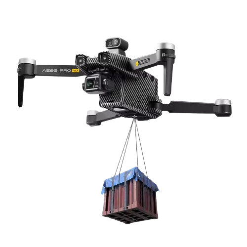
3-Axis Anti-Shake Drone with 4K Camera – Taetron
Advanced drone with altitude hold, 4K camera, G-sensor, foldable design, remote & app
Technical Specifications
| Camera | 4K Ultra HD Camera |
| Material | ABS |
| Operator Skill Level | Intermediate |
| Control Type | Remote Control |
| image transmission distance | 6KM |
| Maximum Flight Time | 28 minutes |
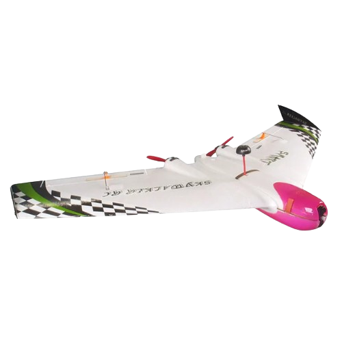
39.21 in FPV Electric Plane with 30 Min Flight Time – Taetron
SKU: Taetron-CZGH-954
Experience high-speed FPV racing or long-range flying with the flying wing RC airplane, designed for performance and durability.
Technical Specifications
| Remote Distance | Air speed: 37.28 miles (60km/h) |
| Controller Battery | 4S 1500 to 3300mAh |
| Features | FPV Capable |
| Video Capture Resolution | 1080p FHD, 720P HD |
| Power Source | Electric |
| Wing Span | 39.21 in (99.6 cm) |
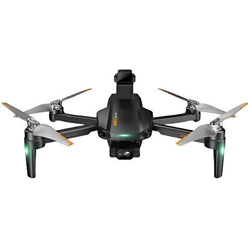
4 K Camera Drone with Intelligent Lidar, GPS & Remote Control – Taetron
SKU: Taetron-ZED-182
Discover the 4 K Dual Camera Drone features Lidar obstacle avoidance, GPS, 4000 m range, 35 min flight time, and remote control, follow me capability.
Technical Specifications
| Material | Plastic |
| Operator skill level | Beginner |
| Control type | Remote Control |
| Image transmission distance | 2.48 mi (4 km) |
| Maximum flight time | 31 min to 40 min |
| Gyro | Six-Axis gyroscope |
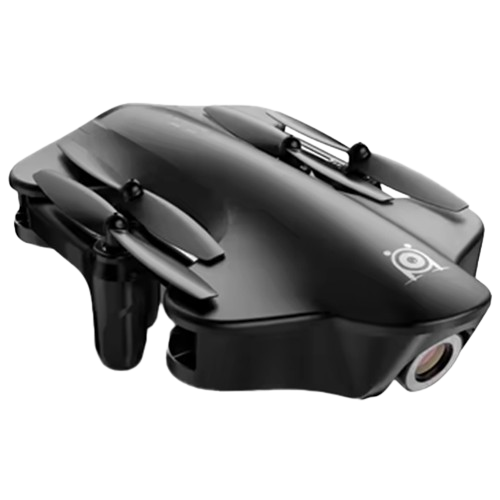
4 K Drone With 120° Wide-Angle Camera, 4-Axis Gyro, Long Range – Taetron
Discover the pinnacle of aerial videography with our Quality RC Folding Long Range Drone, designed for video capture and extended flight distances.
Technical Specifications
| Battery | Li-Po 3500 mAh, 7.4 V + USB interface |
| FM | 2.4 G |
| Age Range | Above 14 years old |
| Remote Control Distance | About 0.06 mi (100 m) |
| Flight Time | About 15 min |
| Charging Time | About 80 min |
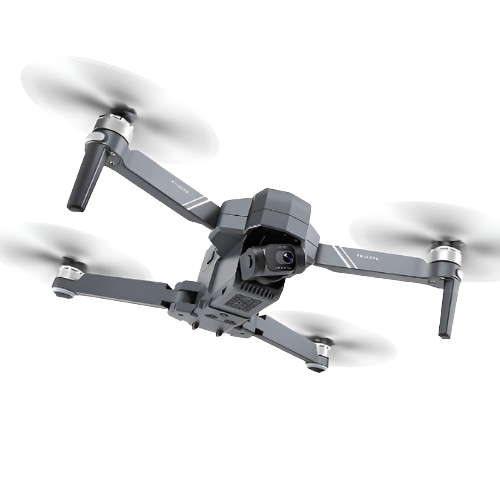
4 K HD Camera Drone With Foldable Design And Stable Flight – Taetron
Explore versatility with our foldable gimbal RC drone, perfect for capturing stable aerial footage wherever your adventures take you.
Technical Specifications
| Control Type | Remote Control |
| Photo Resolution | 3840 P x 2160 P |
| Video Resolution | 1280 P x 720 P |
| Frame Rate | 30 fps |
| Frequency | 2.4 G |
| Drone Battery | 11.1 V, 2500 mAh |
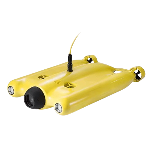
4 K UHD Camera Drone, 12 MP Photos, 4Hr Battery, 500 M Range – Taetron
Discover 4 K UHD camera with 12 MP photos, Light weight design, 4 hours battery operation, 4 knots speed, 328 feet depth and LED lights.
Technical Specifications
| Material | Plastic |
| Style | Radio Control Toy |
| Power | Battery |
| Radio Control Style | RC Hobby |
| Plastic Type | ABS |
| Type | Boat & Ship |
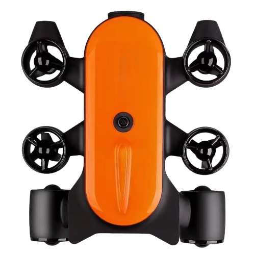
4 K UHD Underwater Drone ROV AUV Robot Camera With LED Lights – Taetron
Intermediate drone with camera, LED lights, G-sensor, 3 D flip, 8km image transmission, and 40 min flight time. Ideal for advanced users.
Technical Specifications
| Material | Plastic |
| Operator Skill Level | Intermediate |
| Control Type | Remote Control |
| Image Transmission Distance | 4.97 mi (8 km) |
| Maximum Flight Time | ≥ 40 min |
| Drone type | Beginner Drones |
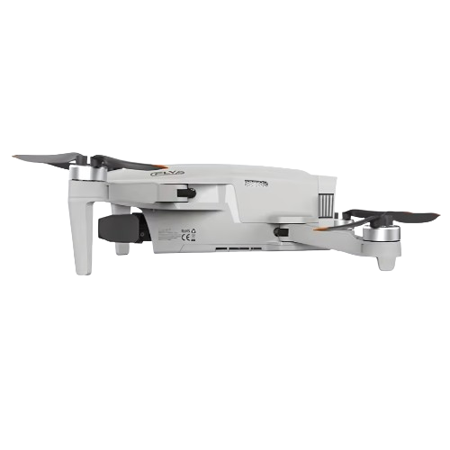
4 K Video Drone with 4 x Digital Zoom, & 3-Axis Gimbal – Taetron
Experience stunning 4K video with 4x digital zoom, 5 km FPV, 3-axis gimbal, intelligent shooting, automatic return, GPS, and level 5 wind resistance.
Technical Specifications
| Material | Aluminium Or Alloy |
| Operator Skill Level | Beginner |
| Control Type | Remote Control |
| Image Transmission Distance | 1.86 mi (3 km) |
| Maximum Flight Time | 31 min to 40 min |
| Gyro | Foldable Drone 0.005 lb (2.4 g) axis gyro |
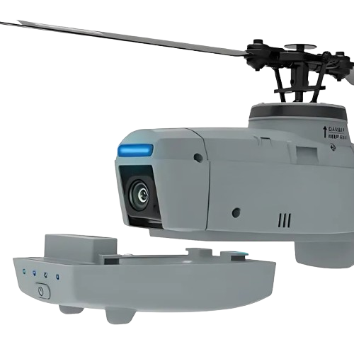
4-Channel RC Helicopter With 720P Camera & 6-Axis Gyroscope – Taetron
4-channel RC helicopter with 720P camera, 6-axis gyroscope, barometer height control, and 15-min flight time. Ideal for all skill levels.
Technical Specifications
| Remote Distance | 328 ft to 394 ft (100 m to 120 m) |
| Controller Battery | 3.7V 580mah |
| Material | Plastic |
| Features | Helicopter with Camera |
| Video Capture Resolution | 720P HD |
| Operator Skill Level | Beginner, Intermediate, Expert |
Power Source
Taetron’s Power source drones, also known as energy drones or battery extender drones, are unmanned aerial vehicles (UAVs) equipped with mechanisms to deliver energy or provide an external power source to remote or hard-to-reach locations. These drones carry batteries, fuel cells, or other forms of energy supply and are designed to transfer power to other drones, ground-based equipment, or installations such as remote sensors and communication towers. This capability significantly enhances the operational time and effectiveness of devices and systems that would otherwise require frequent maintenance or replacement of power sources.
Applications of power source drones span across various industries. In the telecommunications sector, they can extend the range and uptime of relay stations or temporary communication networks. In environmental monitoring, these drones can recharge sensors placed in remote or hazardous areas, reducing the need for human intervention. Additionally, in emergency response and disaster relief operations, power source drones can provide critical energy to support rescue operations and sustain essential equipment in challenging environments.
These drones represent a significant advancement in the field of UAV technology, offering a versatile solution for powering critical systems in diverse and difficult terrains, ultimately improving the reliability and sustainability of operations across multiple sectors.
Navigation and Control Method
Taetron’s Navigation and control methods for drones encompass the systems and techniques that allow unmanned aerial vehicles (UAVs) to operate autonomously or semi-autonomously in various environments. These methods involve an integration of technologies including Global Positioning System (GPS), Inertial Navigation System (INS), and obstacle detection and avoidance systems. GPS provides geospatial positioning and timing, crucial for path planning and waypoint navigation. The INS offers real-time data on the drone’s orientation, velocity, and position relative to a reference point, enhancing stability and accuracy during flight. Additionally, sensors such as LiDAR, cameras, and ultrasonic sensors enable obstacle detection, facilitating safe navigation by adjusting the drone’s path to avoid collisions.
These navigation and control systems find diverse applications in sectors like agriculture, where drones are used for crop monitoring and pesticide application; in delivery services, where they are deployed for quick transport of goods; and in disaster management, where they assist in search and rescue operations. Alternative names for these UAVs include Unmanned Aerial Systems (UAS) and Remotely Piloted Aircraft Systems (RPAS), reflecting the technology’s evolving roles and capabilities in both civilian and military operations.
Flight and Altitude Range
Taetron’s Flight and altitude range (FAR) drones, alternatively known as high-altitude long-endurance (HALE) drones, are unmanned aerial vehicles (UAVs) designed to operate at high altitudes for extended periods. These drones typically reach altitudes between 20,000 and 65,000 feet and can stay airborne for days or even weeks, depending on the power source and design. FAR drones are equipped with advanced navigation systems and long-range communication capabilities, allowing them to cover vast areas.
Applications for FAR drones are diverse and significant. In the military domain, they serve in intelligence, surveillance, and reconnaissance (ISR) missions, providing real-time data and high-resolution imagery. In civilian contexts, these drones are used for environmental monitoring, including tracking weather patterns and assessing the impact of climate change. They also play crucial roles in disaster management, delivering critical information from hard-to-reach areas during emergencies.
Taetron FAR drones are increasingly used in telecommunications as temporary communication relays in remote regions. Their ability to maintain a stable presence at high altitudes makes them ideal for bridging connectivity gaps. As drone technology advances, the potential applications for FAR drones are expected to expand, highlighting their growing importance in various sectors.
Environmental Suitability
Taetron’s Environmental suitability drones (ESDs), also known as Ecological Assessment Drones or Environmental Monitoring UAVs, are unmanned aerial vehicles equipped with sensors and cameras designed for environmental analysis and monitoring. These drones play a pivotal role in assessing the suitability of various environments for ecological, agricultural, or infrastructural projects. By providing high-resolution aerial imagery and real-time data, ESDs can evaluate land topography, vegetation health, soil quality, and water resources, ensuring comprehensive environmental impact assessments.
Their applications are diverse, ranging from precision agriculture, where they monitor crop health and soil conditions, to conservation efforts, where they track wildlife populations and habitat conditions. Additionally, ESDs are employed in urban planning to identify potential environmental risks and in disaster management to assess damage and plan recovery efforts.
The use of ESDs enhances the efficiency and accuracy of environmental assessments, offering a safer and more cost-effective alternative to traditional methods that require extensive manual data collection. With advancements in sensor technology and data processing, Environmental Suitability Drones are becoming indispensable tools for environmental scientists, urban planners, and conservationists, enabling proactive and informed decision-making.
Motor & Wing and Rotor Type
Taetron’s Motor & wing drones, also known as fixed-wing drones, are characterized by their airplane-like structure with wings providing lift and motors for propulsion. These drones are typically powered by one or more motors that rotate propellers, enabling them to fly efficiently over long distances. Due to their aerodynamic design, they can cover vast areas quickly and are well-suited for tasks requiring high endurance and speed.
Applications for motor & wing drones span various industries. In agriculture, they are used for crop monitoring and precision farming, helping optimize resource allocation and increase yield. In environmental monitoring, these drones assist in surveying large tracts of land, assessing natural resources, and tracking wildlife. Additionally, they are employed in mapping and surveying, where their long flight times and high-altitude capabilities provide comprehensive aerial imagery and data collection.
Rotor Type drones, also known as rotary-wing drones or multi rotors, are distinguished by their multiple rotors, typically ranging from three to eight. These drones offer exceptional maneuverability and can hover in place, making them ideal for applications such as aerial photography, videography, and inspections. They are extensively used in infrastructure inspection, search and rescue operations, and delivery services, where precision and agility are critical.